The Black Cat Track - PAPUA NEW GUINEA
A trek from Salamaua to Wau - April 1999
I spent an interesting evening with Jerry's family at their tiny hamlet near Lae called Wankos, not far behind Igam Barracks. Jerry's cousin, Kennedy, was quite vociferous with a number of SP brownies under his belt. My attempts at chewing buai (betel nut) caused much mirth. I couldn't think what to do with the blood-red effluent but aim the distasteful spittle inelegantly through a crack in the floor, possibly garnishing the pet dog down below. It gave a sort of a rush to the head, but the aftertaste wasn't too fantastic, more akin to a dental surgeon's mouth wash. The momentary rush mixed with the SP at least made the visit to the infamous 'haus pekpek' a little less shocking.
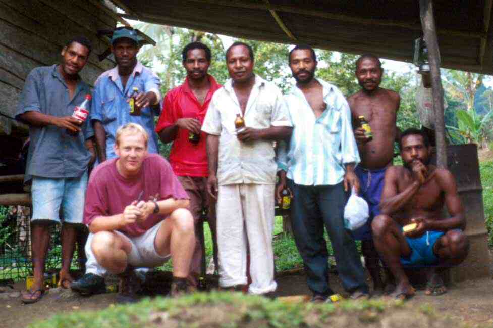
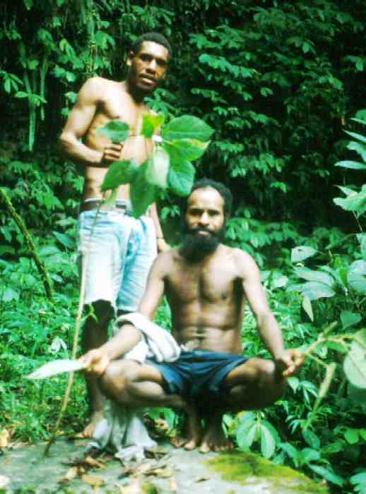
Jerry's tribe
I spent the morning walking around the hamlet, Jerry pointing out all the food sources of the locals, breadfruit trees (kapiak) with their strangely variegated leaves, sago (sak-sak), coconut, taro, sugar cane. There appeared to be no shortage of food in most parts of Papua New Guinea.
Jerry's nephew, Aku (David) wanted to come with me on this little adventure. He seemed a fit, pleasant fellow and his services as a turnim-tok (translater) would become invaluable later on, especially as I had only been in PNG for just over a month. Jerry and Kennedy farewelled us both at the chaotic dinghy hub near the Lae wharf, where all the boat PMVs passed on their coastal voyages. We shared the small space with a few young students returning to the newly opened Salamaua High School. Aku made some valiant efforts to chat them up on the hour and half voyage across the Huon Gulf. The gulf was remarkably flat and calm. The murky turbidity of the Markham River gave way eventually to a typical azure blue as the distinctive knoll of Lae vanished into the distance.
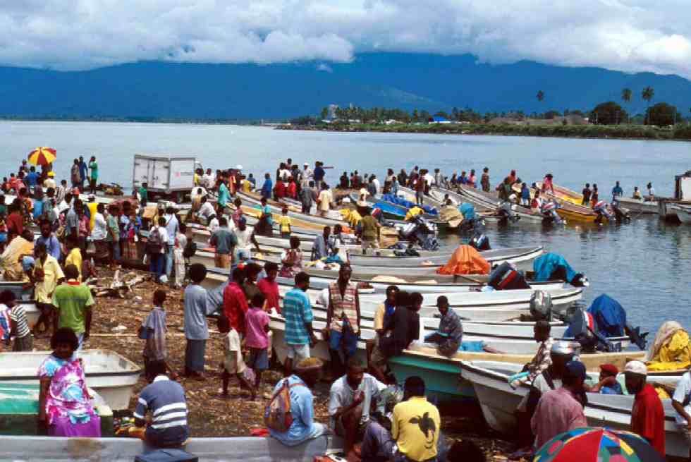
Lae PMV Boat terminus
I think we were slightly deceived by the crafty boatman who dropped us of on a muddy beach lined with coconut palms, thinking this was Salamaua tru. A hot steamy climb up to the School revealed that we were in fact some 1-2km away from the settlement proper. The view did pinpoint some excellent reefs though. Aku and I passed the small coastal settlement of Keila literally straggling down to the edge of the Gulf. The houses were made of a distinctive weatherboards on stilts. The shore was littered with numerous outrigger canoes in various states of decay and cans of tinned fish !! Who could believe that tinned fish be so popular here at K2 a can ( 2 hours work at local labour rates). Radios could be heard blaring from these huts. Because of the high tide we were cut off from continuing to Salamaua by a deep, muddy stream. Fortunately we were saved by a couple of young girls who happily ferried us across in one of their canoes to the other side.
It wasn't long before we were strolling down the main street of Salamaua, now but a grass path between many mouldy fibro houses. It seemed hard to believe that in the 1920's this was one of the busiest towns in New Guinea, being the base for expeditions into the interior in the craze for gold. During the Second World War it also became the scene of some of the heaviest fighting between the Japanese and Australian forces.
The "Haus Kibung" run by a cheerful fellow called Matthew was very basic with no water and electricity, but the chalets were very pleasant. I went snorkelling off the wharf as the afternoon drew to a close. David, being completely unacquainted with the sea donned the snorkel and mask with some trepidation, fearing some nasty encounter with a sea-monster or the sting of the stonefish. The quality of the coral was remarkable. We dined on some lovely local fish caught by John, a highlander of all sorts. John was very keen to acquire some reading materials, although I wasn't quite sure what he meant !
The morning was bright as we followed the coconut avenues past the colourful cemetery to the mouth of the Francisco River, emburgeoning its muddy load into the Bismarck Sea. The crossing looked quite treacherous with the swift current, but we managed to cross without getting too wet, the mouth of the river being quite shallow.
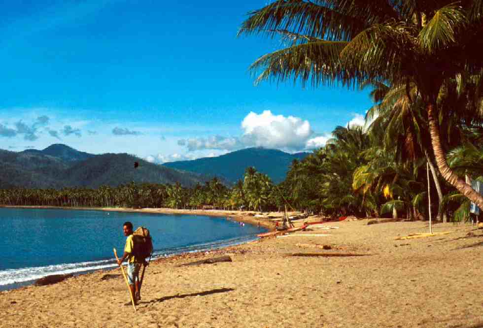
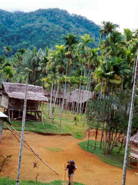
Salamaua Beach
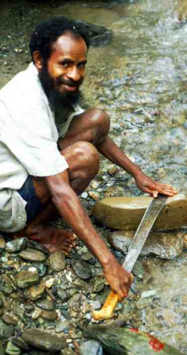
After some negotiation we managed to find a guide, Michael who would take us as far as Mubo village in the Bitoi Valley. We belted through the steamy jungles of the valley floor at an alarming rate. Luckily, I had been fittened by the previous month's work scrambling the high altitude moss-forests of Hidden Valley. We only stopped for Michael to light his Spear cigarette. In PNG these long sticks of sweet tobacco rolled in newspaper are particularly popular. Eventually his matches ran out, and he resolved to rubbing two sticks with tinder to get a flame. Eventually we came to the confluence of the Franscisco and Tambu Rivers at Komiatum Village, but not before clambering around a very steep landslide caused by a spate of recent earthquakes. So far so good I thought as we engorged on a classic lunch of Navy Bisket (with the lovely slogan of "Mekim Bikpela na Strongpela" ), Ox and Palm and spring water.
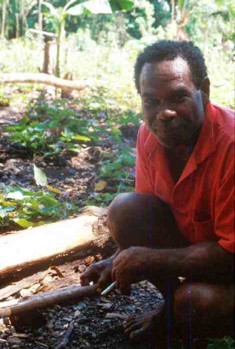
Michael making fire
Such exuberant feelings were very short lived as we suddenly escalated up the steep, never ending knife-edge ridge up towards Mount Tambu. The tall kunai grass trapped the blazing heat of the early afternoon sun cocooning us in heat, sweat and dust. Michael, being a bit of a smart arse grinned mockingly at my struggles, but he wasn't carrying a 25kg backpack. In stages we ascended up to 800m. I was mightily impressed by the rest-stops called for increasingly frequently. Just like Motorway Service stations every now and then we would come across a shady seat made of bamboo poles, looking out over the marvelous view out to valley and sea unfolding before us. Almost all these rest areas had a clump of deliciously refreshing sugar cane nearby. Because of the lack of water on the track, I was surprised and relieved to find that one of the rest-spots had a hook holding several bottles of water from a spring further up. Friendly locals swapped balls of sago wrapped in banana leaves for our biscuits. The sago was boiled with coconut to make it a surprisingly tasty snack, especially with a spot of jam on it.
After what seemed like an eternity, we finally entered the cool shade of the tree line. Massive bomb craters from WWII indicated the ferocity of the battles here in 1942. Michael recounted a story (which was repeated to me at later) of a Japanese assault of the Australian defences on Mt. Tambu. The Australians apparently were outnumbered, but at a crucial moment in the battle a horde of pigs charged down the Japanese, forcing them to flee. A nice story, but questionable in its exactness. From all accounts the Japanese were hated by the locals, because of their inhuman approach to the them.
As the track wound around the summit of Mt. Tambu a spring came into view in which we all washed and quenched our thirst. A spout made from a pandanus leaf showed the bush ingenuity of the locals. Just below the summit we descended to the hamlet of "Niukamp" literally New Camp. This was a wonderfully manicured cluster of bush-materials houses on stilts, interspersed with tall coconut palms. We were offered some refreshing kulau ( coconut milk from the nut) from the local councillor before continuing on. The councillor's hut was lined with browned political slogans and crude calendars in pidgin.
Komiatum "Niukam"
The descent down Guisep Creek was quite a contrast to the infernal climb up Tambu. In the cool of the afternoon skipping across basalt river boulders surrounded by dense rainforest was far more pleasurable. We encountered a group of Mubo villages preparing sago at a creek junction. The orange sago pulp piling up everywhere gave the appearance of a saw-mill. By dusk we had dropped back down to 280m to the junction of the main Bitoi River just before it disappeared into a formidably steep gorge before emptying out to sea. The Bitoi valley was broad and flat with pebbles making the final couple of miles to Mubo village straightforward at the quick onset of darkness. Somebody had made a large geoglyph of a helicopter on the river bed. Apparently Brian, the kiwi MCG pilot flew over here quite often on runs between Wau and Lae and was popularly well known by the villagers.
Our reception in Mubo was hectic. After a gruelling day's walk the task of having to be sociable was very taxing, with hordes of clamorous kids around. We were put up in the guest-house, a bush materials hut in the centre of the village. A smoky fire was lit in the corner to repel malaria laden mozzies. After a couple of hours dining on boiled taro in kulau and rice chatting with the local men we found a guide who would take us all the way to Wau for fifty kina. Api, a short wiry fellow would accompany us tomorrow. I slept fairly soundly with the mozzie net put up for privacy as well as keeping out any errant natnats.
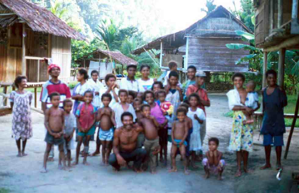
Mubo
We left early, picking up Api on the way out of Mubo. The bush-knife which Michael had been using was nowhere to be found. After some investigations we retrieved it from Michael who was staying with friends nearby. Api, who was only equipped with something resembling an oversized kitchen knife was very impressed with our blade. Hopefully, it would make our trip a lot easier. In a short distance, I became very appreciative of Api's qualities as a guide and his integrity. We passed through a network of gardens, pebbly fords and steep jungle scrambles past landslides and difficult sections of the river before climbing up the steep ascent to Waipali village. The Iwal villages commanded very dominant positions over the steep gorges nearby. Up in the distance another several hundred metres up on another ridge, Api pointed out the fortress like village Guadagasul and its gardens. One could image what tribal fights would have happened here not so many years ago, each village protected by a pallisade of sharpened stakes, much like a porcupine. We lunched in the pleasant, quiet Waipali village. Interestingly the church "bell" was actually a defunct shell from WWII. Api scrounged some lovely juicy Lau_Lau, the small, fleshy, strawberry coloured fruit of the tropical apple. It was very good to relax for half an hour in the shade of the understory of a friend's house.
We pressed on climbing up another 200 metres past an abandoned village whose sole remaining building was now nothing more than a gardening shed or shelter. We entered the tree line to commence our contoured ascent up to the Kuper Range. Over the next two hours the track steepened and deteriorated markedly. My bulk and weight caused the track to give way in many places. On one occasion the track gave way underneath me unexpectedly, leaving me grappling onto the stinging stems of salat and also getting infested with stinging brown ants at the same time. Groves of salat became increasingly thick and widespread. Many trees too big to remove easily had fallen across the track and steps had to be cut into them to prevent slipping into the head high salat. Much of this nasty foliage was of the persistent kind. It took some months before the stings and patches of numbness had vanished from my leg. We crossed a lovely stream where we rested for a while. Api started to flagellate himself with salat. Wondering about his sanity, David informed me of the analgesic qualities of some of the species of salat. The sting would only last a few minutes, but muscle pains would go away. The trouble I had was distinguishing between the good and evil stuff. Apparently the nasty variant has hairier more prickly leaves covered in warts with reddish tinges to it and grows in woody tree-like form. I learnt to avoid the stuff like the plague, almost developing a phobia for the stuff after my last encounter which still stung badly after a few hours. Share and share phobias alike, Api and David who were walking barefoot, cleared away thorn trees and spikes with particular thoroughness. So, we continued like this, scrambling down to creeks, back up again, over and around slippery log falls, landslides and salat till late afternoon. On one occasion we encountered several wild pigs grunting and foraging for juicy forest tubers.
Flagellation
The weather was starting to close in and I was wondering where on earth we would be stopping overnight. It seemed as though we were well short of Aulac Creek, the planned overnight destination where there was supposedly a bush-materials shelter. In a matter of minutes we were subject to an almighty deluge after the first spits fell. We were wet to the bone in no time and the torrential rain just kept coming and coming. We crossed two rivers which were well on their way to full flood and well loaded with brown silty torrents. All the while we were looking around for a suitable campsite. Nothing flat could be seen anywhere. Api was starting to get agitated at being caught out, as night was starting to fall. The rain storm seemed to grow in intensity as we fought across another major creek. I carried a big stick which surely saved me from aquatic peril in the gorge below. Once crossed, we thought it very urgent to find a campsite ANYWHERE, as the gloom hastened navigation and route-finding would become impossible before long. Api and David started clearing a rough looking patch near the river, but this was smaller than the tent's footprint. After a few minutes of saturating struggles I found a salat infested ledge several metres up just big enough for our tent. It was flat though and I commandeered the bushkife to chop down the salat shrubs. The tent was up in a short time. This raised morale considerably and straightaway Api foraged around for any dryish dead fall around. Luckily the rain eased off as darkness quickly fell and it was very comforting seeing some redness in the smoky tinder that was to become a hearty fire. We dined ravenously on rice, Maggi noodles and tinned fish before the three of us packed into the confines of the tent. Everything was as wet as, but sleep ensued.
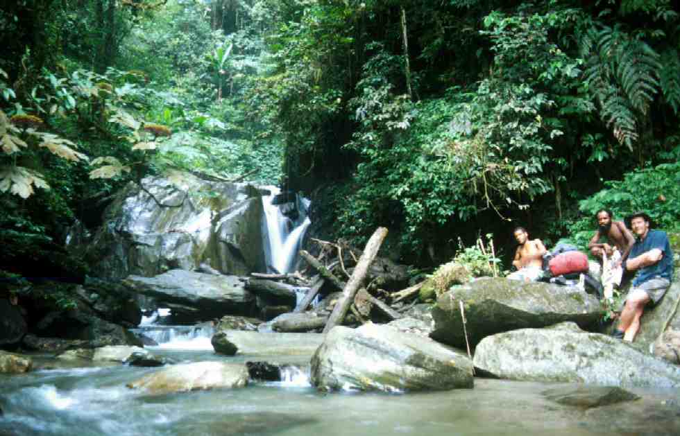
towards Aulac Creek (before the storm hit)
The next morning was cool, clear and fresh, the river below subdued to the normality of a bubbling brook. We scrambled along the variegated terrain, an almost continuous alternation between slippery climbs and even more slippery descents. This section of the track, according to Api had not been used much after the drought two years before, the locals now preferring to use the Skin-Diwai track nearby, a German built and surveyed track several km away. Occasionally we were treated to a reasonably good section of track along the moss covered ridges and glimpses of the ramparts of the cloud forest of the Kuper Range. On several occasions there were tantalising glimpses of the majestic flight of the black long-tail "King of Saxony" bird of paradise weaving through the canopies. Wildlife was in abundance, and the forest was alive with raucous calls of other unseen birds. We passed the local 'kiap' patrol. The kiap these days wasn't the armed white man from before but more of a medical orderly team. Api intuitively sharpened his bush-knife on a creek stone that by the looks of it had plenty of use, before we tackled yet another punishing 500m climb.
The track now deteriorated as we entered a zone of deforestation caused by the devastating 1997 drought. The drought was brought on by the strong El-Nino event which resulted in extensive forest fires over Indonesia and Malaysia as well as torrential flooding and hurricanes (Mitch) in the Americas. The track was a classic "saitem kil" literally "side hill". Dead trees scattered the whole area, Api sorrowfully shaking his head muttering "biksan". Unfortunately for us, being on a contouring track, deadfall of large rain trees had fallen neatly across the track. In the last two years kunai grass had grown thickly along and over the track, making it a extremely treacherous as we (I) couldn't make out where the track was. After a while I swapped my lumbering pack with Api's smaller holdall as my gross weight of about 115kg was causing the track to disintegrate dangerously. I narrowly missed slipping into the gorge on more than one occasion. Hundreds of metres below could be heard the thundering roar of the Bitoi River. Sounds of crashing logs and boulders echoing around the valley. Today the sun was beating down, and the progress was beastily slow. Eventually we came to the confluence of the major upper Bitoi junction, but not before a startling sidle around a slippery ledge. Api said that a few years ago another whiteman slipped here, luckily only suffering the misfortune of a broken leg. Still, what a place to have any kind of injury. The locals had initially given the man up for dead.
Once we crossed the river fork, the track improved immensely, as we were nearing Bitoi village, back on an "A" road in a pedestrian sense. The air was noticeably cooler as we passed the 1800m mark. The river was a bubbling reddish brown indicating the alluvial gold mining upstream which we were soon to bear down on. By 4 pm the sky emptied again in typically gargantuan proportions. We took shelter in a miner's hut filled with a young family sitting around a smoky fire. Api passed around a bag of lau-lau to the clamorous pikinini. After the rain eased off we ascended the grassy ridge to the main fortified village of Buindiama where we accommodated in the dokta-boi's house. We had a very enjoyable evening telling tales around the smoky fire, the din of the downpour outside was almost deafening.
The track to Bitoi was very pleasant indeed, enjoyable in fact, as we passed numerous little hamlets, beautifully bedecked with manicred lawns, flowering gardens, enclosed by manicured hedges and hibiscus groves. The track was at last very walkable. Water races from the 1930s were in evidence everywhere, some still being maintained and used by local miners. Every now and then we would pass a group of these nefarious looking characters who would cheerfully offer us sugar cane, many by the looks of them probably part-time raskols down in Wau town. The Bitoi river was now walkable and we followed its bed along sections of it which were hemmed in by more sedate cliffs than the day before. After by-passing Niucam we ascended the Black Cat saddle up past 2000m. The montane forest was again more predominant here, with patches of klinkii and hoop pine and the quintissential moss mattress. We celebrated the summit of the pass of the Kuper Range with a few shouts of enthusiasm, before going down the roller coaster path to Wau, literally sliding down all the way along a graded 1920's miners track.
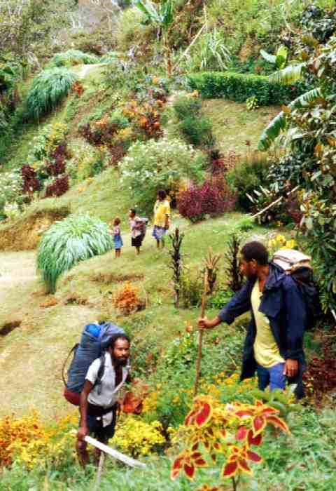
Bitoi garden
Last updated: 30th March 2001
Travels around Gaia |
Return to homepage